
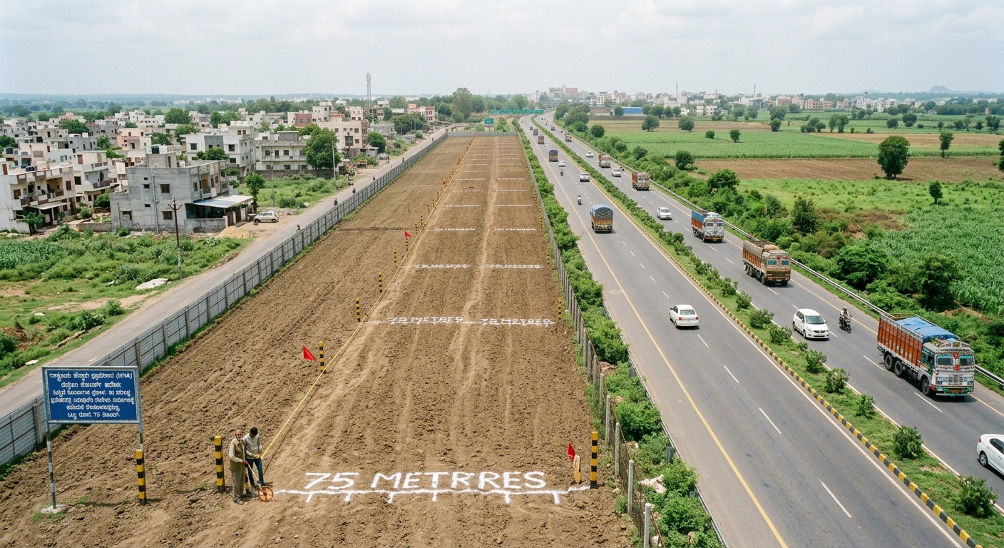
What the Supreme Court’s 2026 directions mean for landowners and property buyers in Karnataka
LANDSKAPE | PROPERTY INFORMATION NOTE | 27 SEPTEMBER 2026:
There is considerable confusion about a reported “75-metre setback” along National Highways. This short guide explains what the Supreme Court has actually directed, what it does not say, and what Karnataka landowners and buyers should verify.
This is an information note, not a legal opinion. Property-specific questions should be checked with the competent authority and qualified professionals.
1. What did the Supreme Court actually direct?
On 13 April 2026, in In Re: Phalodi Accident, the Supreme Court issued a package of highway-safety directions. Among them, the Court directed State Governments to issue notifications prohibiting change of land use within 40 metres for residential use and 75 metres for commercial use, measured from the mid-point of a National Highway and consistent with IRC norms.
This is why the issue is commonly referred to as the “75-metre rule”. However, describing it simply as “75 metres of land beside every National Highway is banned” is misleading.
2. The important distinction
| What it is | What it is not |
| A direction concerning change of land use. | A blanket declaration that private land within 75 m is acquired by the Government. |
| 40 m for residential use; 75 m for commercial use. | A universal 75 m construction setback measured from the road edge. |
| Measured from the midpoint of the National Highway. | A rule that automatically makes every existing building illegal. |
| To be implemented through State notifications. | A statement that every highway-side property has no development value. |
3. Does a landowner lose ownership?
The April 2026 direction is framed around land-use change. It does not itself transfer ownership of private land to the Government or NHAI. Ownership, land-use rights, construction permissions, highway Right of Way (ROW), building/control lines and acquisition are separate legal questions.
The Supreme Court also separately addressed unauthorised structures within the National Highway ROW and required stronger controls over highway safety zones, licences and NOCs. Those directions should not be merged into a simple “75-Metre demolition rule”.
4. What does this mean for existing landowners?
- An existing property should not be judged solely by measuring its distance from the highway.
- Existing lawful use, conversion status, building approval, ROW, planning/zoning and any widening or acquisition proposal should be checked separately.
- A restriction on a future change of land use is different from compulsory acquisition of the land.
- An existing building is a different question from a new proposal to convert, construct, expand or change its use.
5. What about someone buying land today?
A registered sale deed establishes the transaction; it does not by itself guarantee that a future use will be approved. For highway-side land, buyers should obtain evidence rather than relying on statements such as “NH frontage”, “commercial land” or “75 metres is clear”.
- Identify the exact National Highway and competent highway authority.
- Get a proper survey showing the parcel boundary and the highway midpoint/centreline.
- Check ROW and any building/control line applicable to the stretch.
- Verify current land-use classification and conversion status.
- Check the applicable master plan/CDP or local planning zoning.
- Verify highway access/approach permissions where applicable.
- Check for widening, alignment or acquisition notifications.
- Confirm the latest State/local notification implementing the Supreme Court direction.
6. What is the status in Karnataka?
Karnataka is not outside the Supreme Court process. In its order dated 13 July 2026, the Supreme Court recorded that compliance affidavits had been received from only three States/Union Territories at that stage: Bihar, Karnataka and Puducherry. citeturn0search0
This confirms that Karnataka had reported compliance to the Supreme Court. It should not, however, be converted into the much broader claim that “all land within 75 metres of every National Highway in Karnataka is now unusable”. The actual effect on a particular property depends on the applicable notification, road stretch, land-use category and existing approvals.
The Supreme Court proceedings are continuing. On 22 September 2026, the Court continued the interim order and directed that status quo be maintained until the next hearing, listed for 6 October 2026.
Accordingly, this note should be treated as a snapshot as of 27 September 2026 and updated when further Supreme Court directions or Karnataka implementation orders are issued.
7. LANDSKAPE’s practical view
The right question is not simply: “Is my land within 75 metres?”
The right questions are: “Which highway? Measured from where? What is my land-use classification? What is the ROW? What approvals already exist? What use do I want to make of the property? And what does the latest applicable Government notification say?”
LANDSKAPE believes highway-side property information should move from assumptions to document-backed verification. A property may be close to a National Highway and still have development potential, while another property farther away may face different planning, access or zoning restrictions.
Our guiding principle is simple: MEASURE. VERIFY. DOCUMENT. DECIDE.
8. Quick FAQ
Is all land within 75 metres banned?
No. The Supreme Court direction concerns change of land use, with 40 m for residential and 75 m for commercial use, measured from the highway midpoint.
Is 75 m measured from the road edge?
The Court’s wording refers to the midpoint of the National Highway. A property-specific survey is therefore important.
Does the rule mean the Government takes my land?
No. The direction itself is not an acquisition order.
Can I build or convert land within the zone?
Do not decide from distance alone. The current State notification, land-use status, planning rules, highway controls and existing approvals must be checked.
Does this apply to every road?
The cited Supreme Court direction is specifically framed around National Highways. Other roads may have separate rules.
What should I do before buying highway-side land?
Obtain a survey and written/documentary verification of title, land use, zoning, ROW, access and applicable highway restrictions.
9. Sources & disclaimer
Primary references: Supreme Court of India, In Re: Phalodi Accident, Suo Motu W.P. (Civil) No. 9/2025, order dated 13 April 2026; Supreme Court daily order dated 13 July 2026; Supreme Court daily order dated 22 September 2026.
Disclaimer: This publication is for general information and public awareness. It is not a legal opinion, title report, survey, planning certificate, conversion order or Government notification. Rules and court directions may change. Readers should obtain current, property-specific advice from the competent authority and qualified professionals before purchasing, selling, converting or developing land.
LANDSKAPE — Your Property Friend
For property information, verification and responsible decision-making.




Join The Discussion